A 1606 map of the North and Ordnance Survey Maps of Walbottle village, roads, rail and surrounding towns and villages.
A fascinating selection of maps from 1606 to 1946 of the North, Newburn, Heddon on the Wall, Throckley and Walbottle, including North Walbottle Colliery and Coronation Pit. It's interesting to see how Walbottle and the surrounding area has changed over 150 years from 1865. The images below link to the respective Ordnance Survey Map on the National Library Of Scotland website. The link will open in a new browser tab or window.

Published 1606
Northumberland, Cumberland and Durham
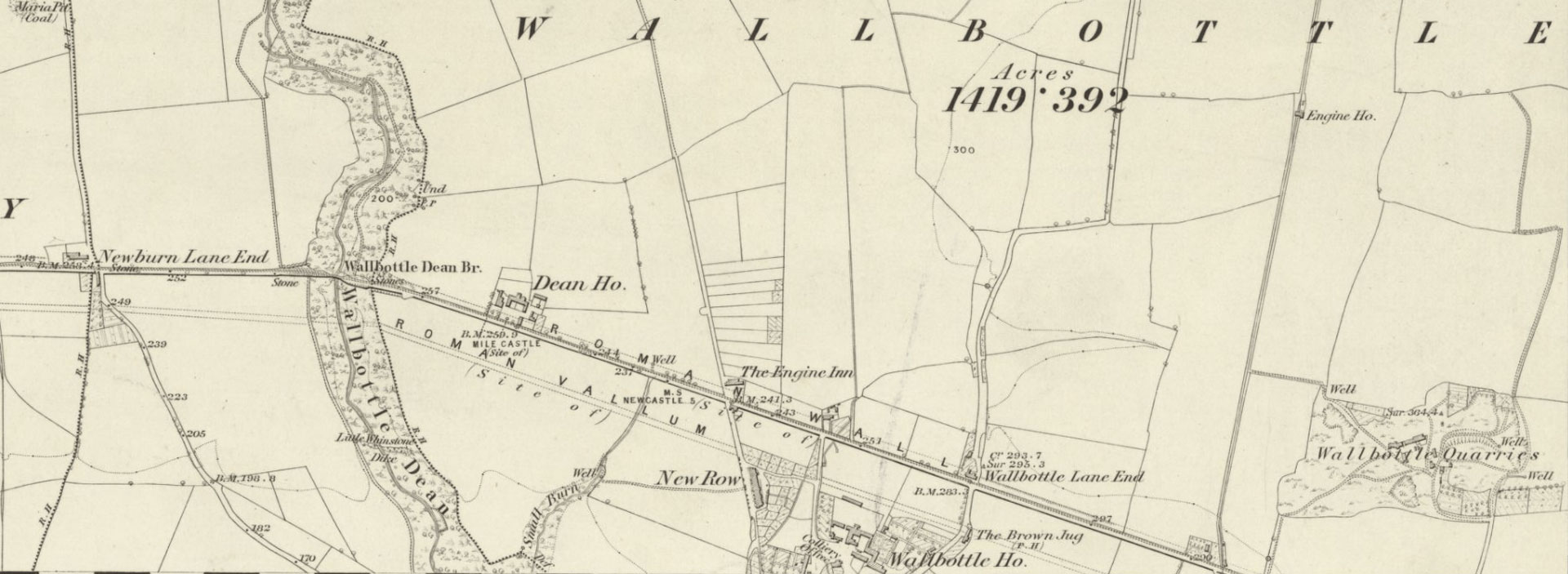
Surveyed: 1860 • Published: 1865
Newburn, Heddon on the Wall, Throckley, Walbottle
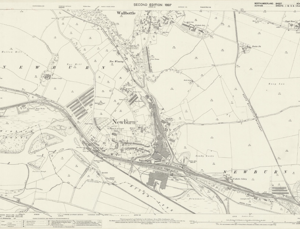
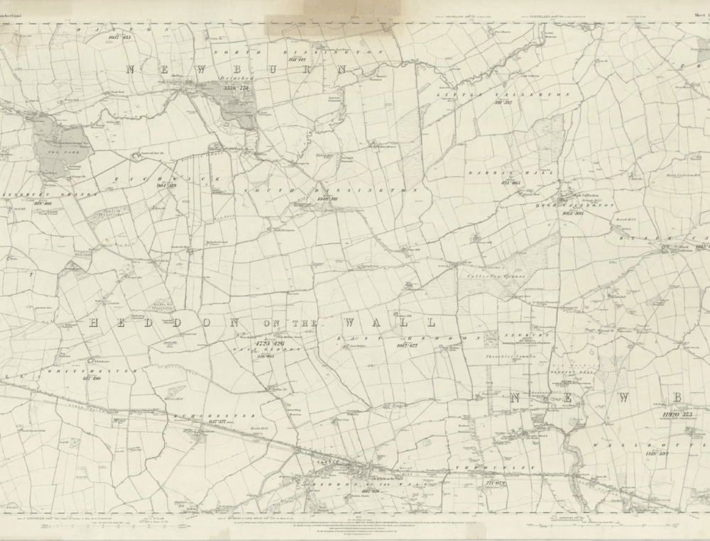
Revised: 1895 • Published: 1897
Newburn, Walbottle
.jpg)
Revised: 1913 • Published: 1920
North Walbottle Colliery and Coronation Pit, Walbottle
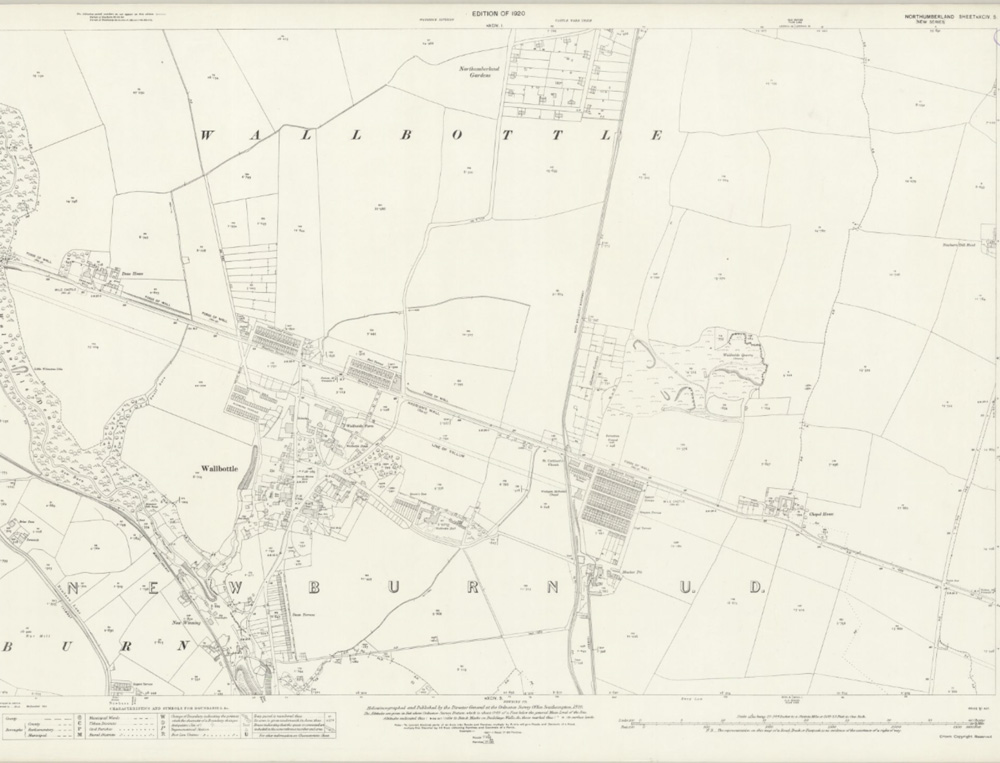
Revised 1913 • Published 1920
Walbottle
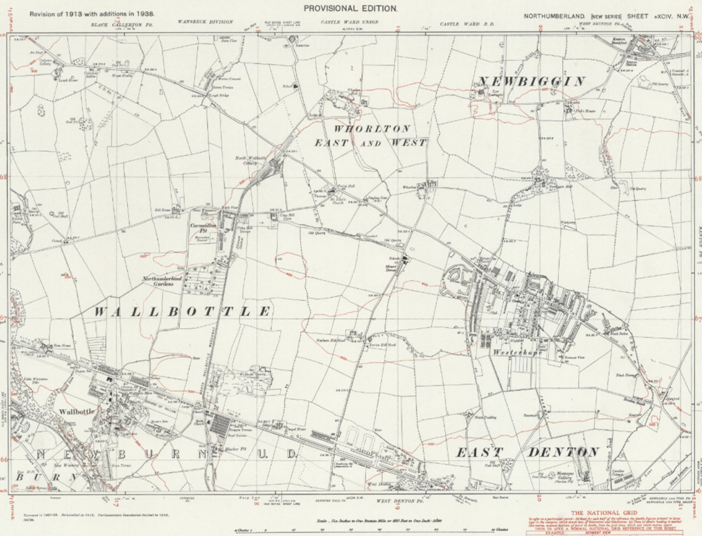
Revised 1938 • Published ca. 1946
Walbottle, Whorlton, Westerhope
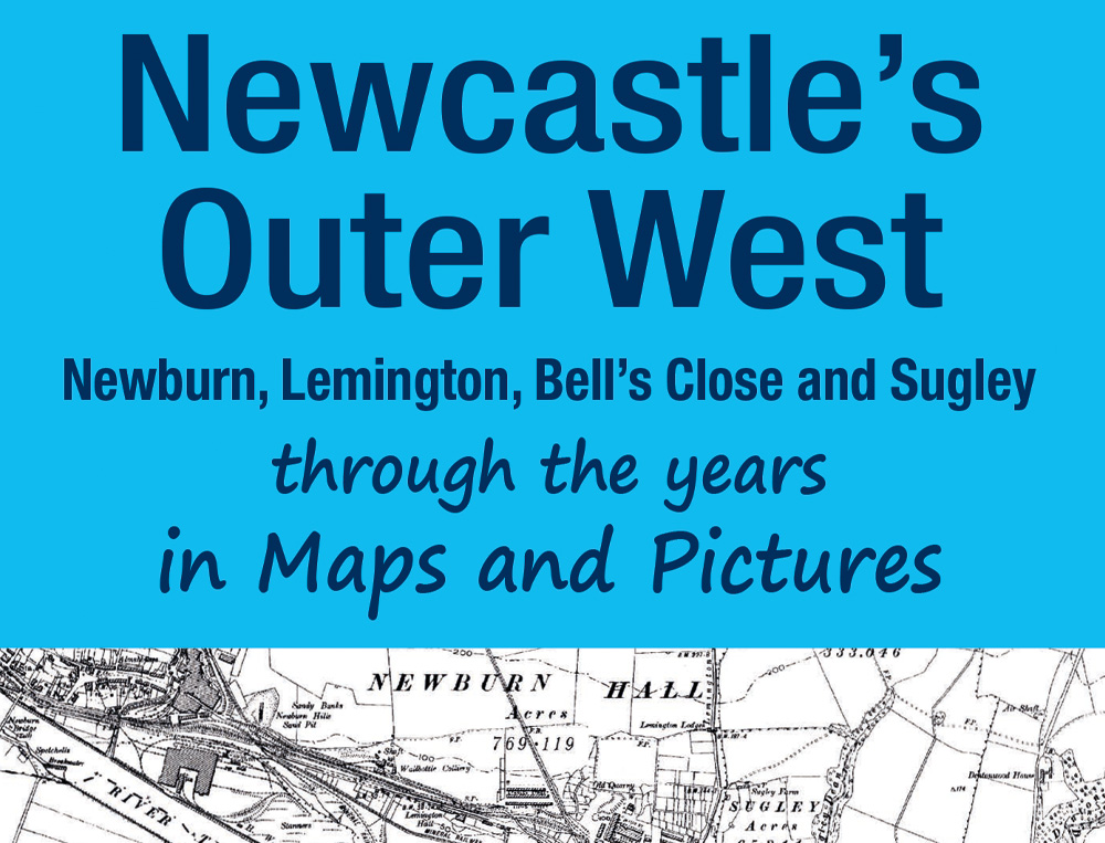
Booklet published in 2021
Newcastle Outer West In Maps and Pictures
 Our Facebook Group
 Email Walbottle Village News